FEMA addresses new flood maps
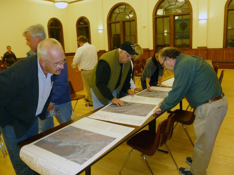
Residents and town officials filled the Music Hall Thursday night to learn about how new flood maps could affect their homes and wallets.
David Mendelsohn of the Federal Emergency Management Authority met with townspeople Thursday night to present and take questions on the newly proposed floodplain maps, which raise the “base flood elevation” from 17 feet to 19 feet.
The proposed maps could put homeowners in higher-risk flood zones and thus increase premiums on flood insurance. These maps are posted in the conference room of the Town House and will be officially updated in January or February, according to Mendelsohn. The town can vote to adopt or reject the maps at the spring Town Meeting. If adopted, they would go into effect either June or July 2012.
The National Flood Insurance Program, created by Congress in the 1960s, was created after many insurance companies stopped providing flood insurance. Mendelsohn added that private sector flood insurance is rare and more expensive.
“The town will, eventually, want to do adopt the maps,” Mendelsohn said. “If a federal disaster occurs, you cannot receive certain portions of money for relief. Insurance rates will go up as well.
Residents who have been placed in a higher-risk zone for the first time have the opportunity to “grandfather” policies offered by the National Flood Insurance Program. Grandfathering allows homeowners to lock in the current flood zone rates. This can be done in two ways: Purchase a policy before the appeal deadline (Dec. 1) or provide evidence that the structure was built in compliance with initial map rates.
“Whatever zone you’re in, you want to keep that locked in,” he said. “Under current laws it’s locked in as long as you keep the policy enforced. Banks keep track of these maps to make determinations on properties with their mortgages. It’s cheaper with the National Program than allowing the bank to tell you to get flood insurance in a certain amount of days.”
Residents may appeal the flood insurance requirement from the proposed maps by filling out a “letter of map amendment,” which requires evidence through a surveyor or engineer showing that the structure’s lowest adjacent ground elevation is at or above the new base flood line.
“We’re required under federal regulations that these appeals be based on scientific reviews to refute the engineering work than has been done with these maps,” Mendelsohn said. “And some people do have better information. We want better information. We want them to be as accurate as they can in identifying risk.”
Yet some residents aren’t so sure about the new maps.
“[FEMA] has caused serious financial concerns with these updates,” said resident Dave Koshiol. “People aren’t going to be able to afford payments. I don’t think they realize what they’re doing.”
Koshiol, who is under a higher-risk zone under the new maps, said there needed to be another meeting that discusses insurance policies and costs.
Resident Richard Jardin said the maps were too confusing to read or understand specific markers of the new flood line.
“It’s impossible to tell what area I’m in,” he said.
Mendelsohn said another meeting could be arranged with the town to bring in insurance specialists to address further questions. Additionally, a DVD containing the map data will be sent to Town Hall to be made available on the town’s website. Residents will be able to download the information and view flood lines more easily.


