New online program gives residents inside look at town
Monitoring your neighbors’ property just got easier and a little bit less creepy.
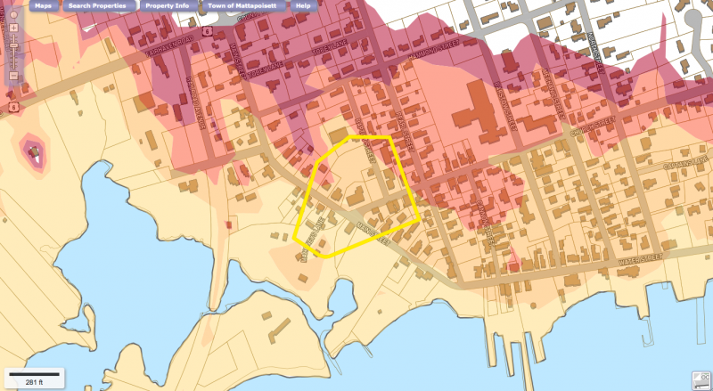
Last week Mattapoisett launched geographic information system software that allows residents to review information on every property in town – from the most recent sale price to whether the basement is finished.
“It’s opened up much more access of information to taxpayers,” said Principal Assessor Kathleen Costello. “It’s a very sophisticated, very current application for the town.”
The town purchased the program with the help of grant money and used several maps already digitized by the state, which saved Mattapoisett thousands of dollars, said Costello.
While the information provided on the program was always available in some format, the program combines maps, specs, and other information that can be viewed without a trip to Town Hall.
Overlay maps include wetlands, hurricane hazard zones, and land conservation. The maps can also be printed from the website.
Costello said other maps such as water and sewer will be added in the future.
In addition to benefiting property owners, developers, and nosy neighbors, GIS will help keep information consistent across town departments.
“We’ll all be on the same page,” said Costello. “If you can Google you can do this.”
To try out GIS for yourself, visit www.mapgeo.com/mattapoisettma.


