Abutters raise questions over 161-foot proposed pier
A new proposed pier in the Aucoot area has raised some concerns and questions among both residents and Conservation Commission members.
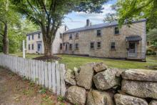
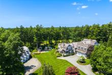
Jay Duker and Julie Starr-Duker of 112 Aucoot Road would like to build a 161-foot long, four-foot wide residential pier from their property into Aucoot Cove as well as a boardwalk across a barrier beach to access it.
Engineer David Davignon presented the plans for the pier at a public hearing on Monday night. The pier would be parallel to the coastline, extending over a saltmarsh area, and then turn to extend into the water. At the end would be a 10-foot by 20-foot float.
“It’s not for large boating vessels by any means,” said Davignon. “It’s actually kayaks, canoes and skiffs.”
Timber pilings 12-inches in diameter would support the structure and decking that allows light to flow through would be used on the area over the saltmarsh.
Davignon said there are two options for construction: a sea and land combination and one done totally from land. Matting used to protect the area and allow the equipment to access the beach would be moved to an upland area at the end of each day.
The Dukers have already submitted permit applications for the Army Corps of Engineers and the Chapter 91 Public Waterfront License.
The Conservation Commission is still in the preliminary phase of its review. The members, who have not visited the site yet, asked for a professional to do an updated eel grass survey of the area and to clearly mark the areas where the pier would be.
Resident Dick Cederberg said the whole area needs to be surveyed again after the winter. He showed the commission members photos taken Monday morning where he said there had been “serious erosion” caused by winter storms.
Although he said he didn’t oppose the pier, Cederberg did question if it could be built as the plans stated.
“My contention is the walkway they want to put down now is not correct. These plans should be brought up to date,” he said. “I would strongly recommend that a delegation from your committee go and review the area – once at high tide, once at low tide. That is the only way to get a true prospectus of the land.”
Devignon said any areas that had been washed away due to the storm could be restored due to permits already secured by the property owners.
There was some disagreement on that matter as commission member Tom Copps said no fill could be put in below the mean high water line.
Next up, abutter Brad Hathaway expressed concern that the pier would cut off access to the area.
“[It] prevents us from going along that beach to the access point around the footing of the pier,” said Hathaway.
He added, “That pier is going to cut off our view to the north and to the northeast. The public use of public lands is very important. Public recreational use of public lands I think is far more important than a single landowner’s right to those same lands.”
Public access is also a concern for Tom and Elizabeth Richardson, who both said the area is important for their family.
“I don’t flat out oppose any piers, per se. In this case, however, that area is very special to our family,” said Tom. “To limit our ability to access that cove concerns us greatly. From what I can measure myself, it would impede our view of the open marshland and the island.”
A wetland bylaw likely to be on the Town Meeting agenda this spring will address recreational uses, but since it has not been passed, the only recourse is to comment on the Chapter 91 Public Waterfront Act license, said Chair Bob Rogers. The license includes public access and recreation.
Rogers suggested residents address such comments to Carlos Fragata of the Department of Environmental Protection Wetlands and Waterways.
Residents also asked about the heavy equipment that would be used in construction and what would happen to rocks in the area.
The commission asked for answers to those questions and voted to continue the hearing on April 27.


