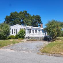
Confusion over road status contributes to Cross Neck Road floods

MARION — A one-mile-long, half-paved road stretching from Marion Golf Club to Brainard Marsh confounded area residents and board members alike during the Selectmen’s meeting on April 6.
Parties debated whether Cross Neck Road truly lies on public or private land, and who should be charged with maintaining a road that, despite its normality in nearly every light, has proved enigmatic in ownership.
David Gulley, of the Cross Neck Road Homeowners Association, presented evidence to suggest the road was indeed a public way. It is listed as such, he said, on the Marion website and in town records; cited as such by the land title company and twice by the town council.
“So I guess my question here is, is there any evidence suggesting that it isn’t a public way?” Gulley said. “What kind of evidence do we need to present? Because it’s apparent that what’s been presented so far is not sufficient.”
The road’s ownership may have remained unquestioned if it weren’t for the mid-1990s installation of a storm drain and drain pipe that, according to Gulley, poured water into a south-side private property. When new owners blocked off the drain in 2019, water began flowing out over the road.
Since then, Gulley said, the road has worsened with “each and every rainstorm.” But before the slow, steady flooding is addressed, the status of Cross Neck’s west end must first be resolved.
Despite receiving a “deluge of information” regarding the road, including Gulley’s presentation and additional documentation, Board Member Norman Hills said no answers were yet apparent.
The road is referenced in an 1846 Rochester town meeting, Hills said — back when Marion was part of Rochester. But when the towns were separated, it is not known what became of Cross Neck.
“I don’t know if [the road] transferred with us or not, to tell you the truth,” he said.
Other sources, Hills said, claim only the east end — the paved portion — of Cross Neck Road is town-owned.
Though Town Administrator Jay McGrail was initially convinced that it was a town road, he said another look at the 1930-34 land court decision revealed that “it clearly does state it’s the easterly end of the road.”
More digging is clearly needed, McGrail said. But the ability of Marsh, Moriarty, Ontell & Golder — the title research company employed by the town — to access the trove of land records held by the Registry of Deeds has been stymied by the pandemic.
“Ultimately, there’s a situation that could present itself here where we don’t have a definitive answer one way or the other,” McGrail said.