











A look back at the hurricane of 1938
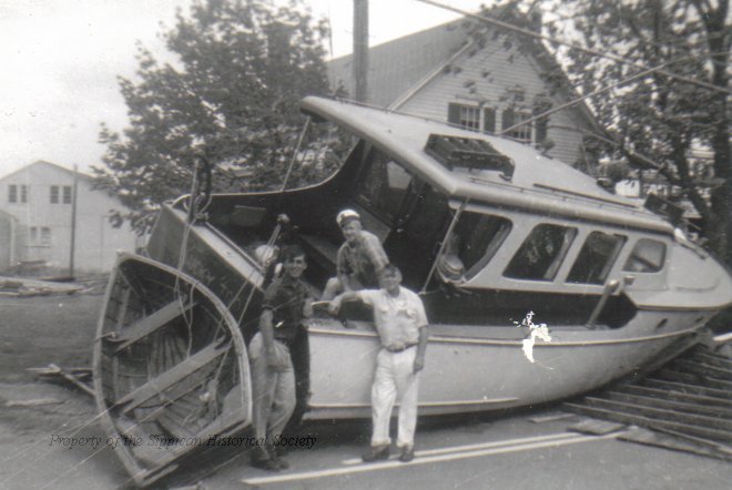 Marion residents stand near a washed up boat on Front Street in the aftermath of the hurricane of 1938. Photo courtesy of: Sippican Historical Society
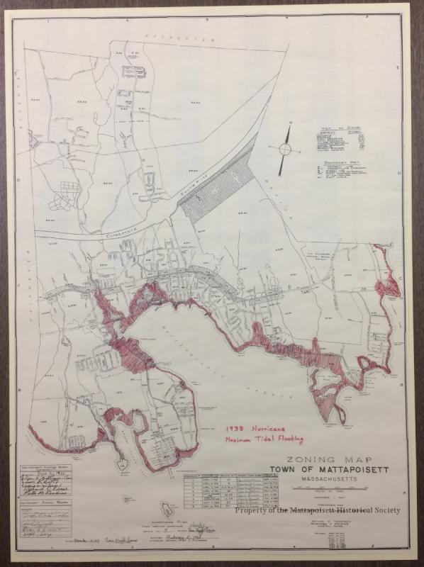 The red area on the map shown notes the flooding that took place in Mattapoisett. Photo courtesy of: Mattapoisett Historical Society
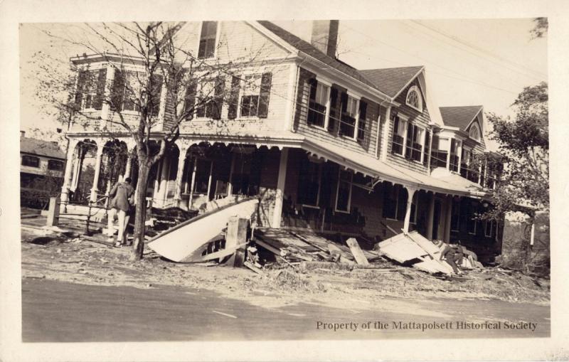 Photo courtesy of: Mattapoisett Historical Society
 Students from Tabor Academy had to think fast as the water took over the pier at Lillard Hall. Photo courtesy of: Sippican Historical Society
 Houses were leveled at Crescent Beach. Photo courtesy of: Mattapoisett Historical Society
 Barden’s Boatyard suffered damage as well. Photo courtesy of: Sippican Historical Society
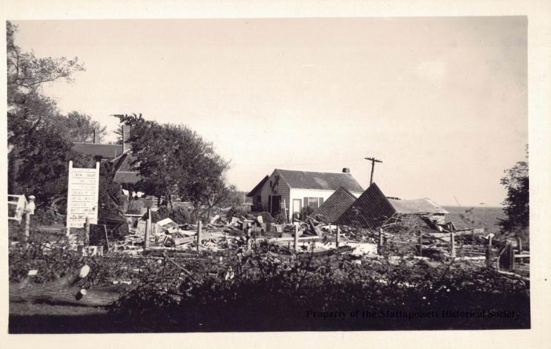 Photo courtesy of: Mattapoisett Historical Society
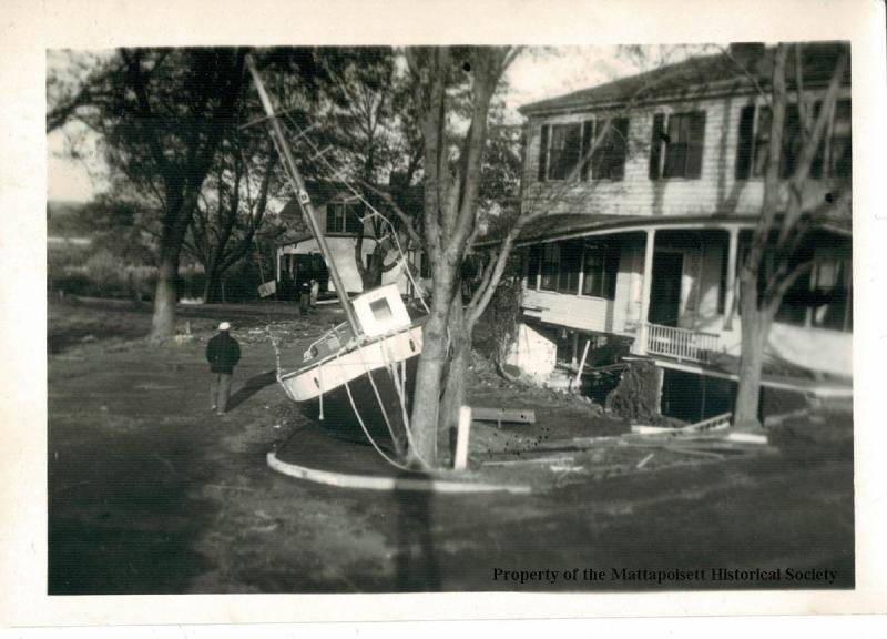 Photo courtesy of: Mattapoisett Historical Society
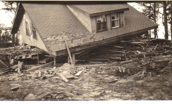 Kittansett Cottage. Photo courtesy of: Sippican Historical Society
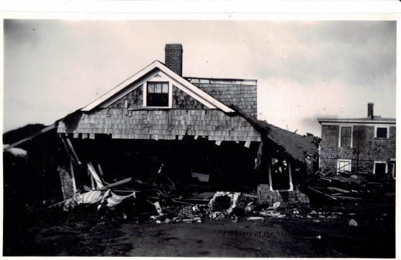 Photo courtesy of: Mattapoisett Historical Society
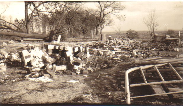 Pine Grove in Marion. Photo courtesy of: Sippican Historical Society
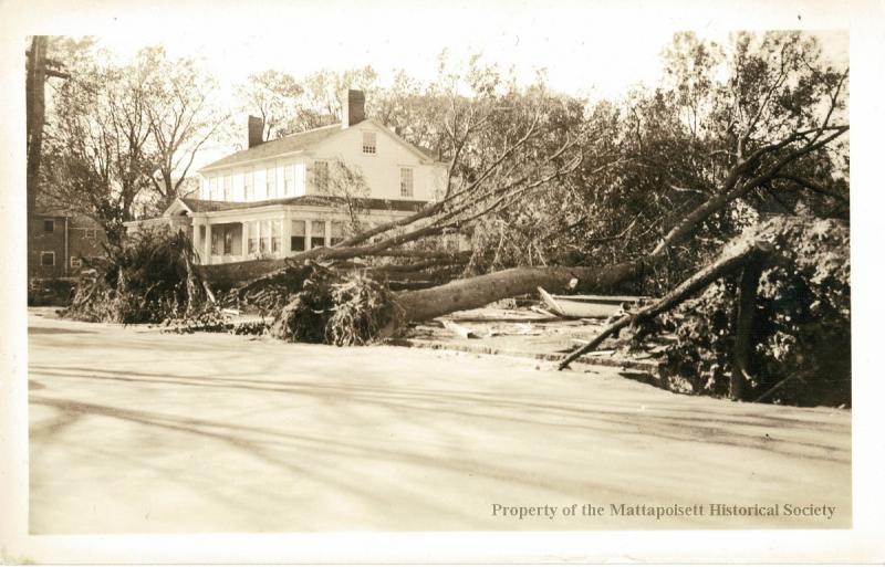 Photo courtesy of: Mattapoisett Historical Society
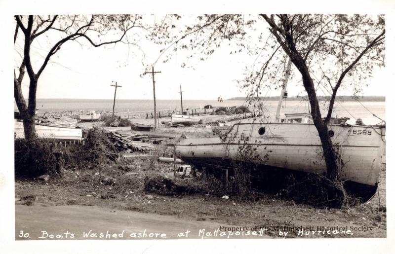 Photo courtesy of: Mattapoisett Historical Society
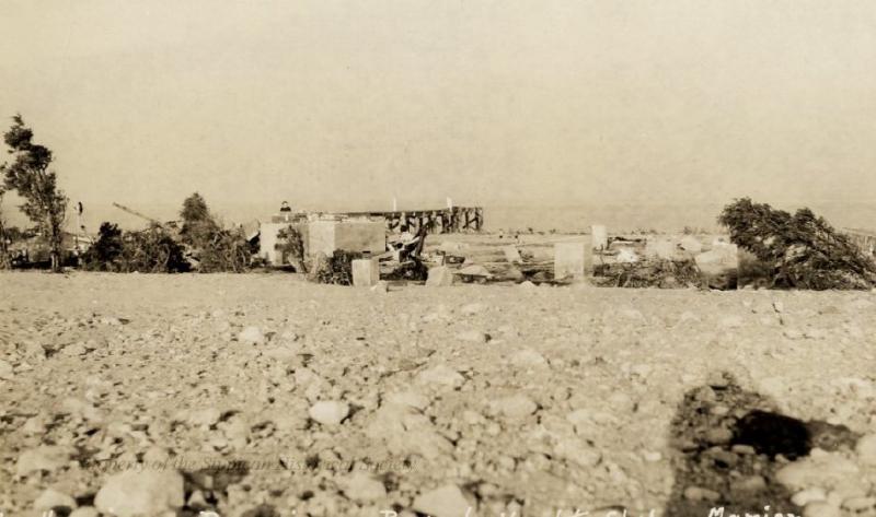 Beverly Yacht Club. Photo courtesy of: Sippican Historical Society
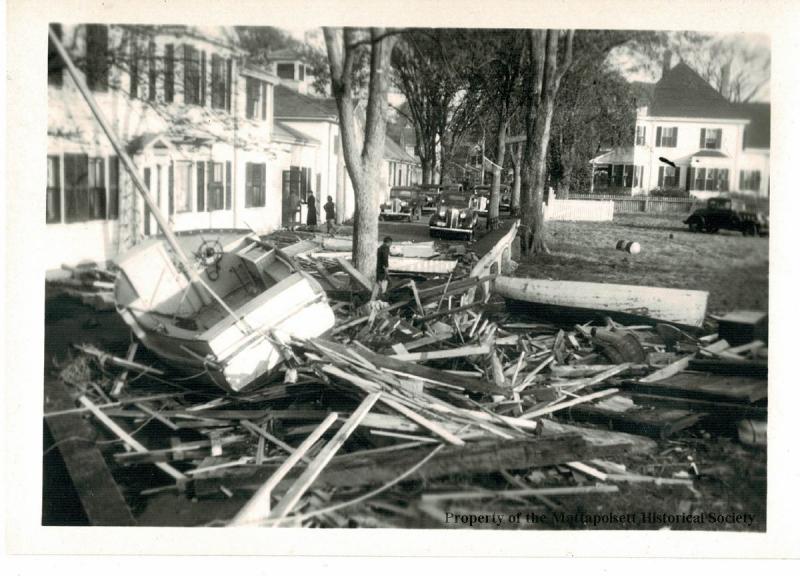 Photo courtesy of: Mattapoisett Historical Society
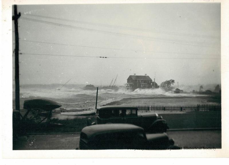 Photo courtesy of: Mattapoisett Historical Society
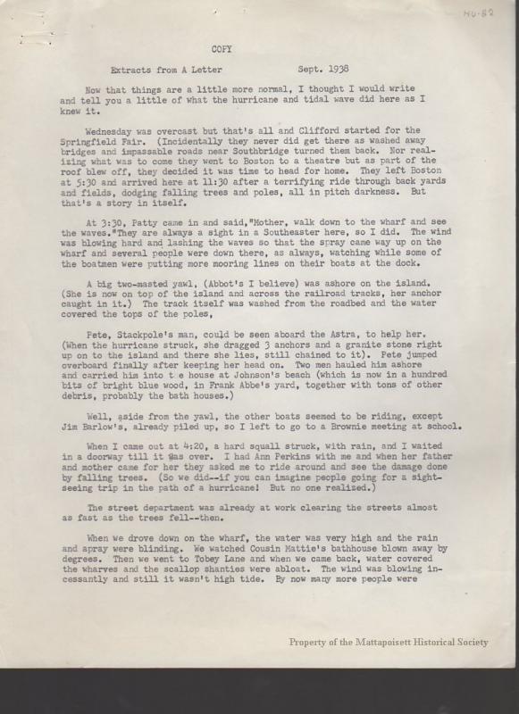 A firsthand account of what the storm looked like in Mattapoisett.
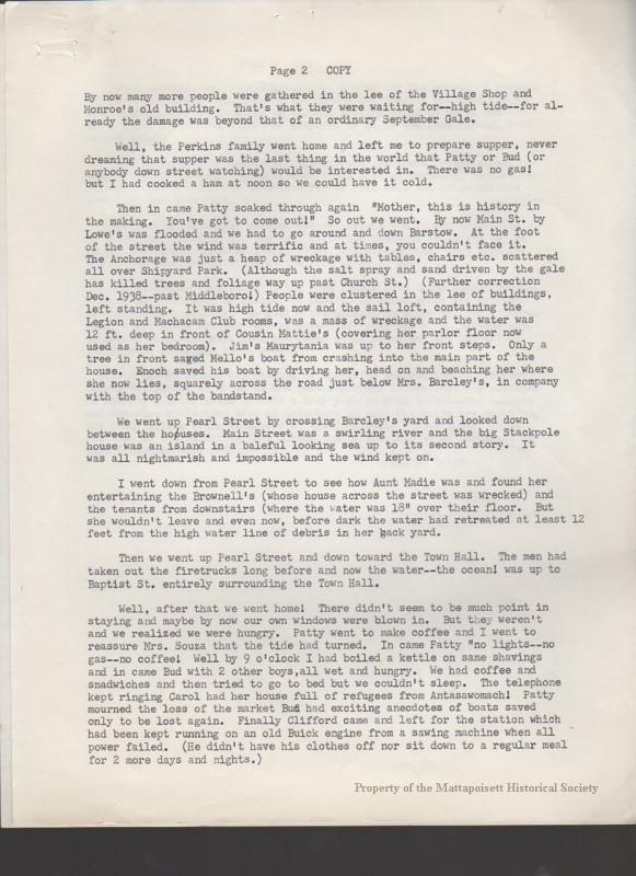 Part two
 Part three
 A time-stamped play-by-play of the storm’s arrival on Ned’s Point Road.
 Part two
 Part three
 Part four
Marion residents stand near a washed up boat on Front Street in the aftermath of the hurricane of 1938. Photo courtesy of: Sippican Historical Society
The red area on the map shown notes the flooding that took place in Mattapoisett. Photo courtesy of: Mattapoisett Historical Society
Photo courtesy of: Mattapoisett Historical Society
Students from Tabor Academy had to think fast as the water took over the pier at Lillard Hall. Photo courtesy of: Sippican Historical Society
Houses were leveled at Crescent Beach. Photo courtesy of: Mattapoisett Historical Society
Barden’s Boatyard suffered damage as well. Photo courtesy of: Sippican Historical Society
Photo courtesy of: Mattapoisett Historical Society
Photo courtesy of: Mattapoisett Historical Society
Kittansett Cottage. Photo courtesy of: Sippican Historical Society
Photo courtesy of: Mattapoisett Historical Society
Pine Grove in Marion. Photo courtesy of: Sippican Historical Society
Photo courtesy of: Mattapoisett Historical Society
Photo courtesy of: Mattapoisett Historical Society
Beverly Yacht Club. Photo courtesy of: Sippican Historical Society
Photo courtesy of: Mattapoisett Historical Society
Photo courtesy of: Mattapoisett Historical Society
A firsthand account of what the storm looked like in Mattapoisett.
Part two
Part three
A time-stamped play-by-play of the storm’s arrival on Ned’s Point Road.
Part two
Part three
Part four
Story Location
United States
Hurricane season is in full swing on the east coast of the U.S. Though there are no storms projected to hit the South Coast at the moment, a category five hurricane began its progression towards the Tri-Town around this time in 1938. The storm, which made landfall in the area on the afternoon of Sept. 21, flooded the coast and upended homes and boats in Marion and Mattapoisett.
Known as the Great New England Hurricane, or the Long Island Express Hurricane (it hit both regions), the tropical storm sustained winds of up to 160 miles per hour, and it caused $306 million worth of damage.
Letters that account the storm’s arrival called it “history in the making.”
In its aftermath, residents walked the streets to find boats dropped in the middle of the road by flooding, and homes and businesses completely leveled by the winds and water.
Though the hurricane had no name (it swept through before the World Meteorological Organization began naming them in 1953), the storm would be remembered by residents for decades to come.
Click through the photo gallery to see the damage from the Great New England Hurricane and read firsthand accounts of the storm as it approached the Tri-Town.
Event Date