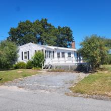
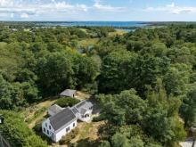
Tri-Town at risk for natural disaster damage


On the tail of Tri-Town flooding from the remnants of Hurricane Ida and a near-miss by Hurricane Henri, Marion has released a draft of its Hazard Mitigation Plan, months in the making.
The plan details the potential effects of a major storm on the town, and what residents can do to protect their homes from flooding and storm damage.
The plan was developed with the Woods Hole Group, and is similar in nature to a Coastal Resiliency Plan released by Mattapoisett in 2016. One major difference, however, is that Mattapoisett’s 2016 plan focuses mainly on the risks associated with town infrastructure, where Marion’s plan takes into account the effect of a major storm on the town as a whole.
Plans like these, town officials and local experts say, are vital for when — not if — a major storm hits the Tri-Town.
“It’s not a question of if it’s going to happen — it’s just a question of when,” Marion native and climate scientist Jennifer Francis said.
She said that a storm with the same intensity as the last hurricane to hit the region, Hurricane Bob in 1991, would likely cause much more destruction now due to factors such as rising water levels.
In Mattapoisett, there are signs marking the highest water lines caused by Hurricane Bob. At Town Beach, the marker reaches the height of the chain-link fence surrounding the beach — around four feet off the ground.
“It’s going to be even worse now,” Francis said, in towns like Marion and Mattapoisett. She added that Rochester would likely be saved from the worst effects of a storm like Hurricane Bob.
Marion’s Hazard Mitigation Plan outlines in detail the relative risks to the town of a wide variety of natural hazards ranging from the highly likely — like severe weather and coastal erosion — to the statistically improbable — such as damaging earthquakes and tsunamis.
The plan not only ranks each natural disaster based on its likelihood but also by its potential severity and whether its effects would be localized to small areas or felt townwide.
According to the plan, severe winter weather, hurricanes and tropical storms are the greatest natural danger to the Marion as they are each deemed “likely,” “potentially serious” (or even “catastrophic” in extreme cases), and threaten the entire town equally.
The next most dangerous event is flooding which is “likely” and would cause extensive damage, though its risk score is muted by the fact that its effects would be isolated primarily to the coast and low-lying areas.
For example, much of the Point Road area of Marion is projected to be completely inundated by flooding if a severe storm hits the town in 2070, virtually guaranteeing Great Hill would be cut off from the rest of town. In 2030, the earliest projection given by the plan, there would be about a 5% annual chance that Great Hill would become a temporary island.
“People have to realize this is a projection,” said Eileen Marum, a Marion Planning Board member and part of the Hazard Mitigation Plan team. “It’s an attempt to give people information on what they can expect.”
She said one of the most important things families can do to prepare for storms is prepare an evacuation plan — especially in the Point Road and Converse Road areas.
“They should think about the quickest route to safety,” Marum said.
In addition, Marum said residents should pay close attention to the advice of the fire and police departments during a natural disaster, and it’s vital those departments remain operational during a storm.
“That’s where the communication will be coming from,” she said.
National storm surge hazard maps used in Marion’s plan indicate that many areas of both Marion and Rochester are at risk of storm surge nine feet above ground in the event of a category one hurricane. Should a stronger hurricane hit the area, the projections are even more dire. Projected storm surge over nine feet for a category four hurricane reaches far north of I-195 in Marion, Mattapoisett and Rochester.
Francis said tropical storms and hurricanes are a big concern for the Tri-Town, as they become larger and intensify faster.
“We are looking at a tightened possibility of a big hurricane,” she said.
Francis said the best way to combat the worst effects of a large storm now is to ensure the public is acutely aware of the potential risks.
“Getting the hairs on the back of their necks standing up,” she said.
But, Francis noted, there’s a “silver lining” that comes with a higher frequency of national disasters not just on the east coast, but across the country.
“It’s an opportunity to really get people paying attention,” she said. “And let them know that climate change is here today.”