











Mattapoisett wave buoy helps researchers study state’s coast
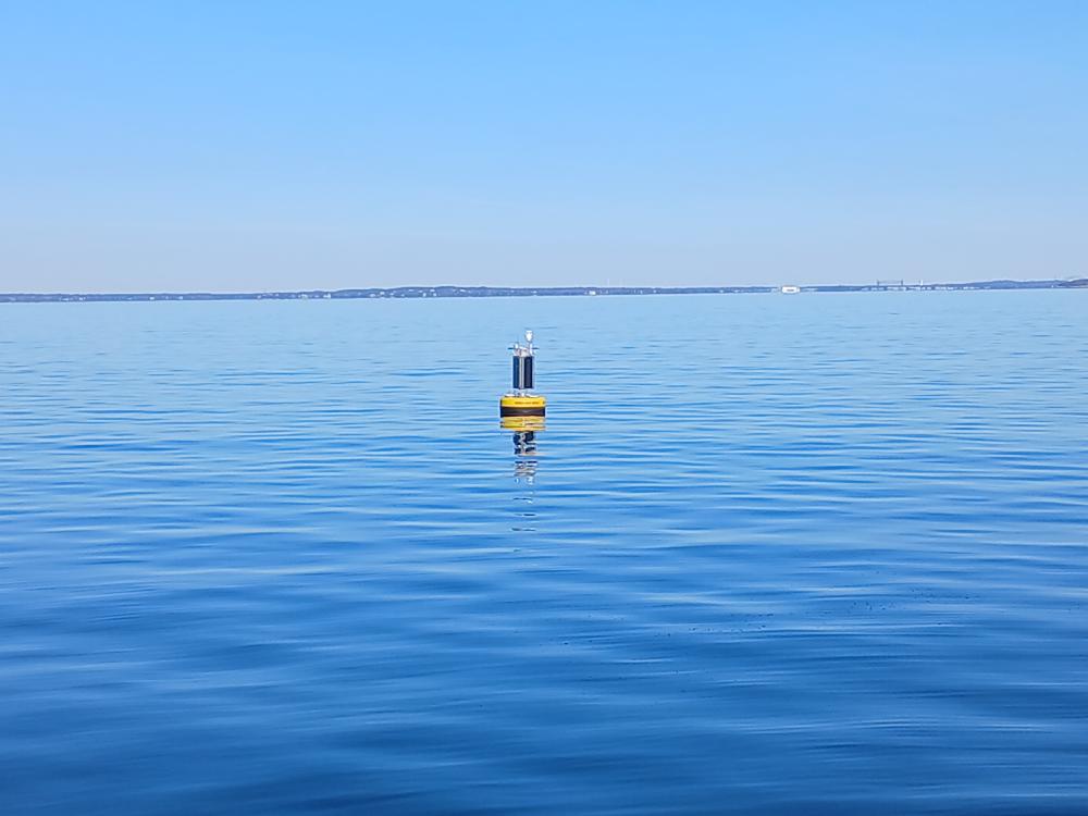 An offshore wave buoy floats off the coast of Mattapoisett in Buzzards Bay. Photo source: Stone Living Lab.
An offshore wave buoy floats off the coast of Mattapoisett in Buzzards Bay. Photo source: Stone Living Lab.
An offshore wave buoy floats off the coast of Mattapoisett in Buzzards Bay. Photo source: Stone Living Lab.
MATTAPOISETT — Off the coast of Mattapoisett floats a yellow buoy, monitoring the height, frequency and direction of the waves that pass under it.
It’s part of several new monitoring instruments the Stone Living Lab installed across the coast of Massachusetts to track long-term trends and help communities predict possible coastal flooding.
The Stone Lab is a research partnership between UMass Boston and other Boston, state and federal partners. The lab previously focused on monitoring the waters around Boston, but has expanded its reach to the South Coast.
Joe Christo, the lab’s chief resilience officer, said the team examined gaps in current monitoring efforts and chose to place an offshore wave buoy in Buzzards Bay to fill one of these gaps.
The Stone Lab is just one of several groups studying the waters of the Massachusetts coast, and Christo said the Mattapoisett buoy is part of a larger network of sensors in the state.
He said the location was also chosen because it was a place where “having a better sense of wave information would really be beneficial for local and state leaders.”
The sensor serves a dual purpose — it is part of a larger network the lab relies on to track changes in the state’s waters, but it also provides information for residents and members of municipal government.
While the buoy may look hi-tech, Christo said it isn’t equipped with any cameras. He said the lab plans to add signs informing people about what the equipment is used for and reassuring them there are no cameras in use.
“We don't want folks to think that there's any issues related to privacy,” he said. “It's really just about collecting climate conditions and how they're changing and helping to provide better data for residents to be more connected to their waterfront.”
All of the data the equipment collects is available on a dashboard interested residents can visit. Christo said this can connect people with information about the water surrounding their community and provides educational opportunities for students to learn about the area’s environment.
This data can also be useful when planning for the future, especially as part of coastal resilience projects.
“These instruments can really help local leaders at the community and municipal level make more informed decisions about exactly how to plan for climate adaptation,” Christo said. “I think that the data and information from these instruments and from the network can really help with that local decision making.”